Impressive and Unique
Wending its way up the Mediterranean coast, and weighed down with its cargo of Egyptian wheat, the great merchant ship was headed for Rome and its bustling grain markets. But why not detour, thought the Greek shipmaster, and see if the rumors of a new port on the shores of the kingdom of Judea were true? Even from a distance, he had to be impressed; the sudden appearance of a deepwater harbor where there was no natural bay was an engineering feat unprecedented in the ancient world.
As his barge entered the calm waters and laid anchor, the captain blinked at what he saw. Ship after ship, the vessels were ranged along the jetties and unloaded simultaneously. The port’s facilities were remarkably sophisticated, while the new city beckoned just beyond, its markets, circuses, and amphitheater tempting sailors ashore. His crew deserved a day or two to enjoy them, the shipmaster told himself, and his wheat might even fetch a good price. The city he’d discovered, Judean Caesarea, was everything it was cracked up to be and more.
These paragraphs are pure imagination, of course, but Caesarea probably indeed dazzled its first visitors. When was this port built and why, and how did it come to be destroyed so quickly?
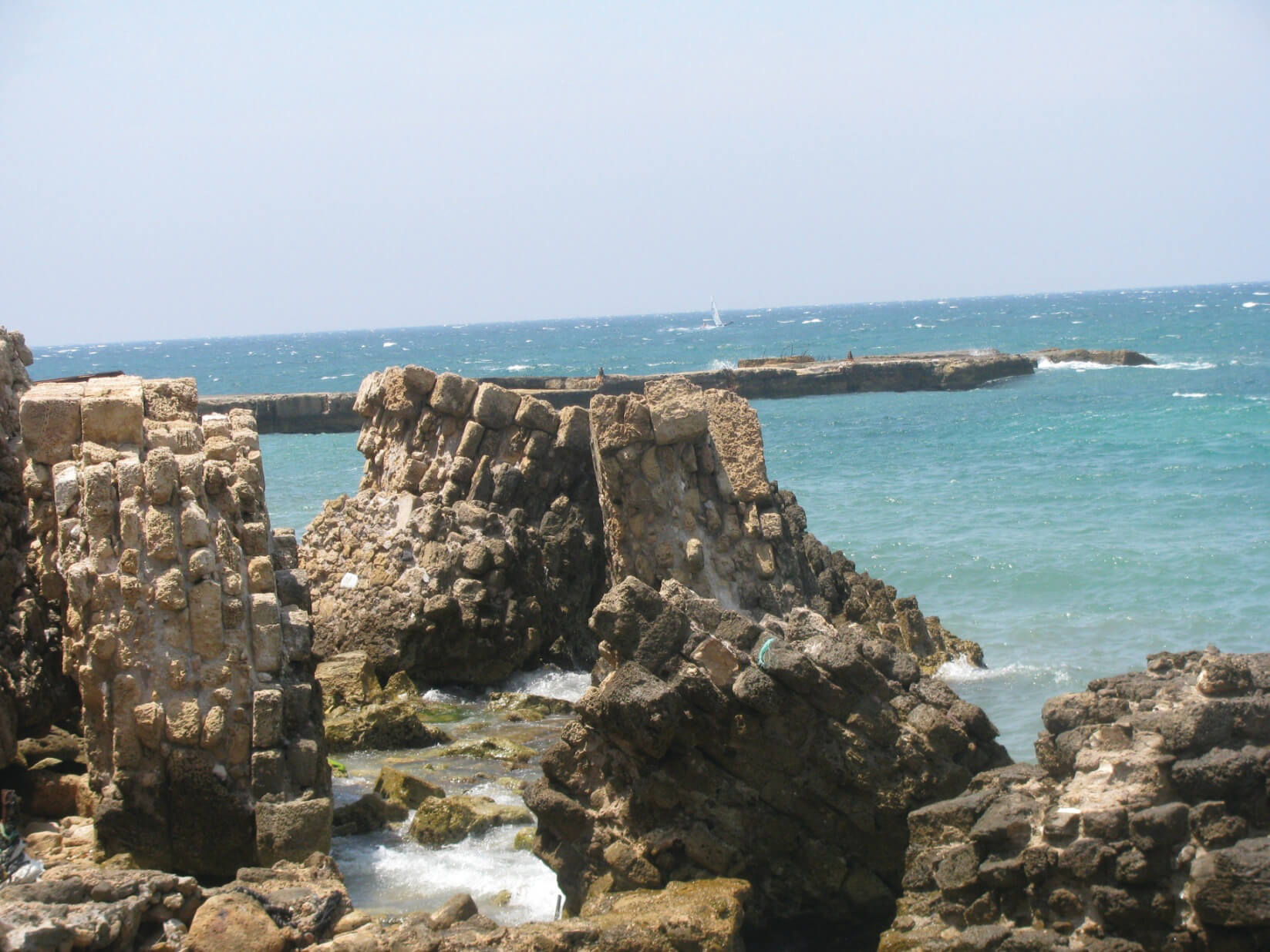
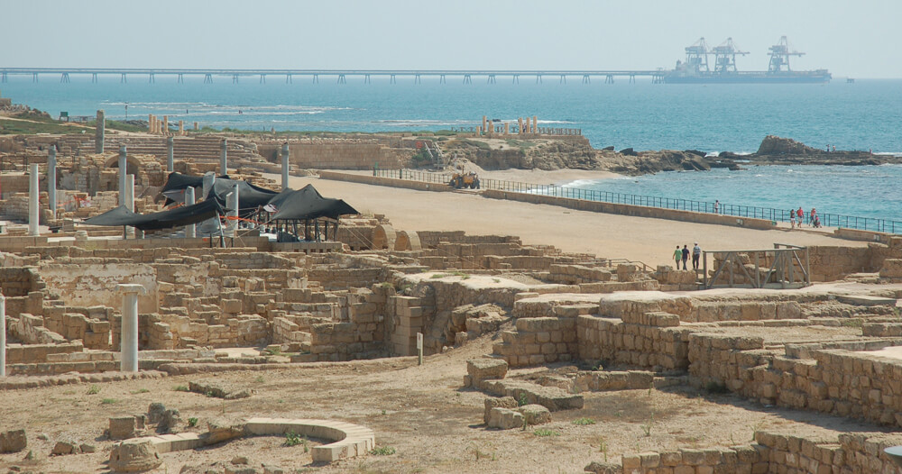 Photo: David King
One of the most excavated sites in Israel, Caesarea shows that Josephus’ descriptions were no exaggeration. Herod did indeed create a Roman polis – complete with amphitheater, hippodrome, and forum – where previously there was barely a village. View of the ancient port today
The Royal Harbor
The story of Caesarea begins in the Hellenist period, when Alexander the Great’s successors ruled his vast empire. The city started out in the third century BCE as a small trading post named for Abdashtart, king of the Phoenician city of Sidon, on today’s Lebanese coast. Jewish sources called the town Shorshan Tower, while the Greeks used their version of its founding monarch’s name, yielding Strato’s Tower. The place is also mentioned in the Zenon Archive, a collection of papyruses left by an Egyptian official who traveled all over the ancient Near East on business in the mid-third century BCE. He describes a walled settlement with a sheltered anchorage and a secondary port to its north.
The Hasmonean king Alexander Janneus captured the town in 90 BCE, and Jewish rule continued until the Romans conquered Judea in 63 BCE. They upgraded Caesarea to a polis, a self-governing city, but the real turning point came after they installed Herod as king, and he embarked on a series of ambitious building projects. Caesarea was designed as a classic Roman metropolis, complete with an amphitheater, circuses, Roman baths, pagan temples, a theater, and the jewel in the crown – Herod’s mighty port.
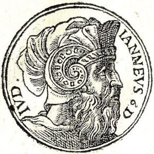 Guillaume Rouille, wood engraving from Promptuarii Iconum Insigniorum (France, 1553)
Portrait of Alexander Janneus, Hasmonean king.
Construction began in 22 BCE and was largely completed by 15 BCE, when Herod’s friend Mark Agrippa arrived for a royal tour. The last stone was in place five years later. Administered separately from the town, the harbor was directly controlled by Herod, and the fees and duties exacted from its customers flowed straight into his treasury. While scholars debate whether Herod’s rule (40–4 BCE) was benign or otherwise, all agree that when it came to impressing his Roman patrons, money was no object. But his endeavors had to be paid for – by heavy taxation and outright confiscation of property from Jerusalem’s wealthier citizens, including seizure of the Hasmonean palaces – facts that have made Herod decidedly unpopular among Jewish historians. None, however, would deny that his greatest technical achievement was the port of Caesarea and the surrounding township.
Given Herod’s Roman education and extensive diplomatic ties abroad, the port was crucial to his international strategy for Judea. Open seas were essential to his foreign policy, allowing him to place his kingdom at the center of a vast network of trade and diplomacy. He named the port Sebastos – a Greek translation of Augustus, the name taken by Julius Caesar’s successor – and dedicated it to the Roman emperor.
Herod’s vision could never have been realized without Roman technology, especially the mixing of hydraulic cement for underwater building. The method was described by Marcus Vitruvius Pollio, one of the greatest engineers of the time, in his book On Architecture, and the port of Caesarea is the earliest known example of the technique’s large-scale use. For the Jewish historian Josephus, the port confirmed Herod’s tactical brilliance in recognizing the necessity of Roman patronage for his kingdom’s development. The sheer mass of imports employed in constructing the artificial harbor, together with its phenomenal cost and extravagant inauguration, sent a message loud and clear – Judea was oriented first and foremost toward Rome.
His [Herod’s] notice was attracted by a town on the Caesarea coast, called Strato’s Tower, which, though then dilapidated, was, from its advantageous situation, suited for the exercise of his liberality. This he entirely rebuilt with white stone, and adorned with the most magnificent palaces, displaying here, as nowhere else, the innate grandeur of his character. (Josephus, The Jewish War [Loeb Classical Library, Harvard University Press, 1997], vol. 1, p. 193)
 Etching, provenance unknown
Herod the Great
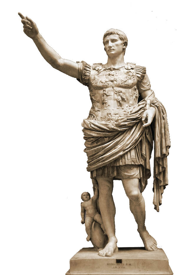 Photo: Till Niermann
King Herod’s patron. Augustus, Julius Caesar’s adopted son, succeeded him as ruler of the Roman Empire and established the first Roman imperial dynasty. Augustus of Prima Porta, first century, now in the Vatican Museums
Building by the Book
It must have been obvious to Herod that close contact with Rome demanded a safe, deepwater, all-weather harbor, where ships could remain anchored for long periods. The Mediterranean crossing was undoubtedly the fastest way to convey messages, and in view of the volatility of Roman politics, he needed to keep up to date with developments.
Built in the second half of Herod’s reign, Caesarea served as an international, secular counterweight to the religiously complex regional capital in Jerusalem. Situated on the city’s northern coast, facing Rome, and a stone’s throw from the land route crossing Judea from east to west, Caesarea was an ideal choice. There were relatively few Jewish settlements in the area, and the pagan population centers of Phoenicia and Samaria were nearby. Josephus links the building of Sebastia, a Roman polis in Samaria also named for Augustus, with the construction in Caesarea. Together with Herod’s “city of horsemen” in Gaba (Geva Parashim), at the bottom of the Jezreel Valley, the two formed a strategic triangle, effectively cutting off the Jewish settlements of the Galilee – where opposition to both Herod and Rome was widespread – from the rest of Judea.
The challenges of building a large harbor in the open sea, where sudden storms could swiftly and radically alter working conditions, were enormous. The job required myriad artisans, sailboats, and marine digging equipment, barges to transport the raw materials from all over the Mediterranean coast, tugs and ferries to position them in the seabed, a system for unloading all the above, and extensive storage space. All this necessitated a functional anchorage from which boats could safely sail out to build the breakwaters, quays, and jetties – an incredible logistical task. The details and coordination involved in such a vast engineering project would be daunting today; that someone in the first century BCE could even conceive of them is firm testament to Herod’s genius.
The directions left by Vitruvius provided Herod and his builders with the inspiration they needed:
But if we have a situation without natural advantages, and unfit to shelter ships from storms, it is obvious that we must proceed as follows. If there is no river in the neighborhood, but if there can be a roadstead [anchorage] on one side, then let the advances be made from the other side by means of walls or embankments, and let the enclosing harbor be thus formed. Walls which are to be underwater should be constructed as follows. Take the powder which comes from the country extending from Cumae to the promontory of Minerva, and mix it in the mortar trough in the proportion of two to one.
Then, in the place previously determined, a cofferdam … is to be driven down into the water and firmly propped there; … finally, concrete from the mortar trough – the stuff having been mixed as prescribed above – must be heaped up until the empty space which was within the cofferdam is filled up by the wall. (Vitruvius, The Ten Books on Architecture [Harvard University Press, 1914], book V, p. 162)
Josephus, who would have visited the port a century after it was built, is the only historian to describe it, explaining, by the by, why it was so badly needed:
For the whole seaboard from Dora to Joppa, midway between which the city lies, was without a harbor, so that vessels bound for Egypt along the coast of Phoenicia had to ride at anchor in the open when menaced by the southwest wind; for even a moderate breeze from this quarter dashes the waves to such a height against the cliffs that their reflux spreads a wild commotion far out to sea. However, by dint of expenditure and enterprise, the king triumphed over nature and constructed a harbor larger than the Piraeus [the harbor in Athens], including other deep roadsteads within its recesses. (Josephus, Jewish War, vol. 1, p. 193)
Josephus details just how skilled Herod’s engineers were; how familiar they were with local sea conditions, adapting their building program accordingly; and how exactly they followed Vitruvius’ instructions.
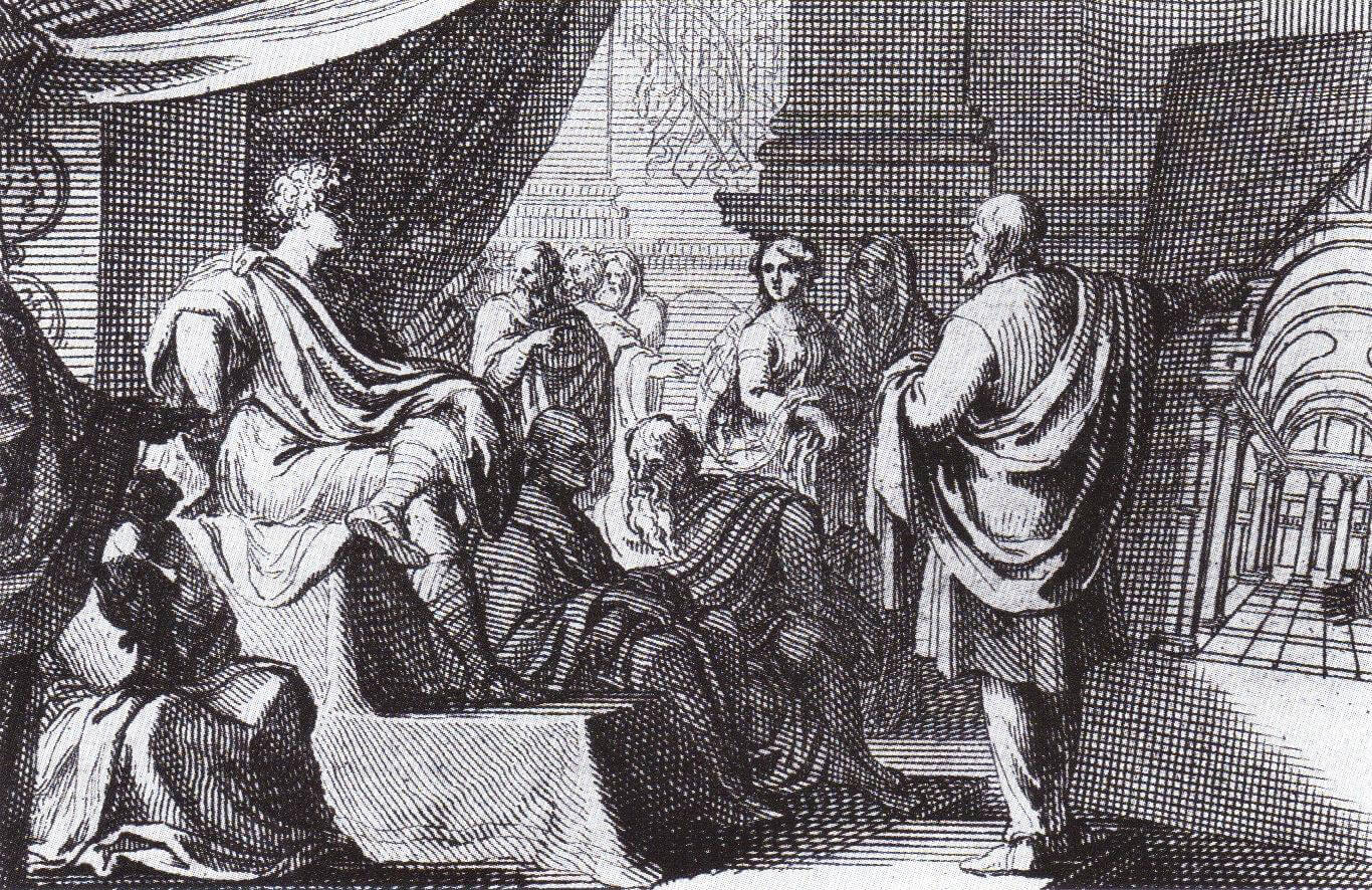 Detail from Sebastian Le Clerc’s engraving in Thomas Gordon Smith’s 1684 edition of On Architecture
Vitruvius presenting his architectural vision to Emperor Augustus
The Height of Roman Technology
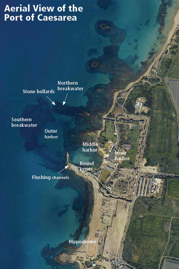
The results of a decade of underwater digs conducted in Caesarea starting from the 1990s corroborate Josephus’ depiction of the port. The discoveries made by a delegation of archaeologists directed by the late Prof. Avner Raban (founder of the University of Haifa’s Department of Marine Civilizations) show that the port consisted of three bays, each closer to shore than the last. The positions of the northern and southern breakwaters, closing off the outer bay from the open sea, are still visible below sea level. The northern breakwater is 60 meters wide and 270 long, extending from east to west. The southern pier was built as an arc, enclosing the port from the southwest. The pier’s width ranges from eighty to two hundred meters (it was probably seventy meters across but was widened by falling stones over the years), and it’s six hundred meters long! The entrance to the bay was through a gap sixty to eighty meters wide, at the northwest corner. Just east of the entry channel, a large pile of hewn stones was discovered, apparently the remains of an impressive structure at the end of the northern pier. Square depressions were carved into the corners of some stones, with a round hole at the center of each. These holes held wooden stakes connected to a metal chain closing the entrance to the port. Josephus describes it all to a tee:
… Herod laid out a circular harbor enclosing enough space for large fleets to lie at anchor, near shore, and (along this line) he sank enormous rocks to a depth of twenty fathoms. Most of these rocks were fifty feet in length, and no less than eighteen in breadth, and nine in height. …
The structure which he set in the sea as a barrier was two hundred feet (in width). Half of it was opposed to the surge of the waves and held off the flood of waters breaking there from all sides, and was therefore called a breakwater. The other half, supported on a stone wall, was divided at intervals by towers, of which the largest, a very handsome thing, is called Drusus, taking its name from Drusus the stepson of Caesar, who died young. Into it had been built a series of vaulted recesses as shelters for sailors, and before them there was a wide quay which encircled the harbor and was a very pleasant place to walk around for those who wished to do so. The entrance or mouth of the harbor was made to face north, for this wind always brings the clearest weather. … On the left of those sailing into the harbor was a tower resting upon piled stones … while on the right were two great stone blocks, larger than the tower on the other side, which were upright and joined together.
In a circle round the harbor there was a continuous line of dwellings constructed of the most polished stone, and in their midst was a mound on which there stood a temple of Caesar, visible a great way off to those sailing into the harbor, which had a statue of Rome and also one of Caesar. The city itself is called Caesarea and is most beautiful both in material and in construction. (Josephus, Jewish Antiquities, vol. 15 [Loeb Classical Library, Harvard University Press, 1998], pp. 417–9)
Traces of the towers Josephus knew have been located on both sides of the harbor entrance. Fifty meters northwest of the gap between the two breakwaters, two great blocks of concrete rise from the seabed, marking the way for incoming ships.
 -
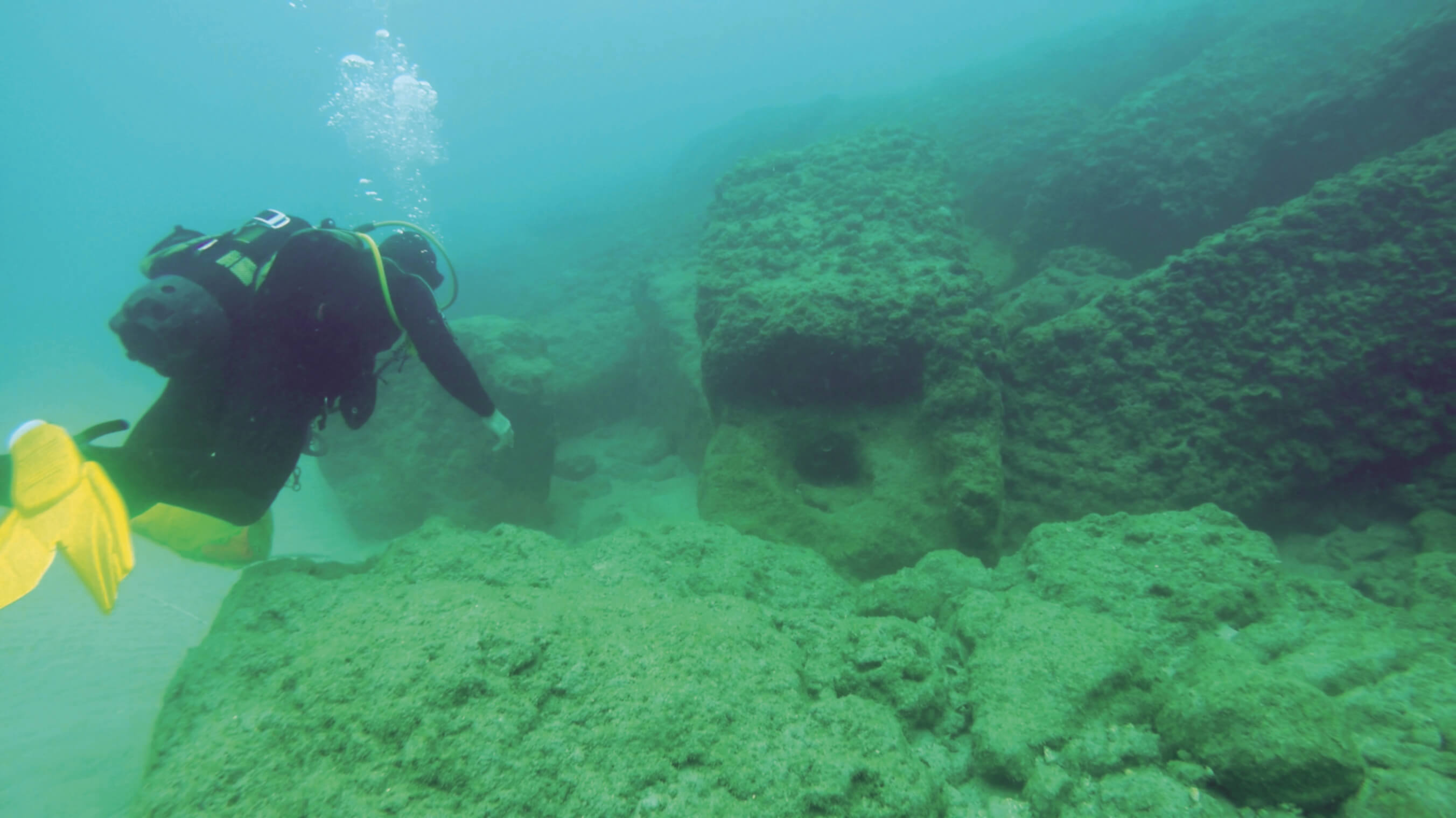
-Violent winter storms off the Israeli coast from 2010 onward have flushed most of the sand out of the middle harbor, exposing long hidden archaeological remains as well as wreckage and cargo from ill-fated ships, such as this anchor
 -
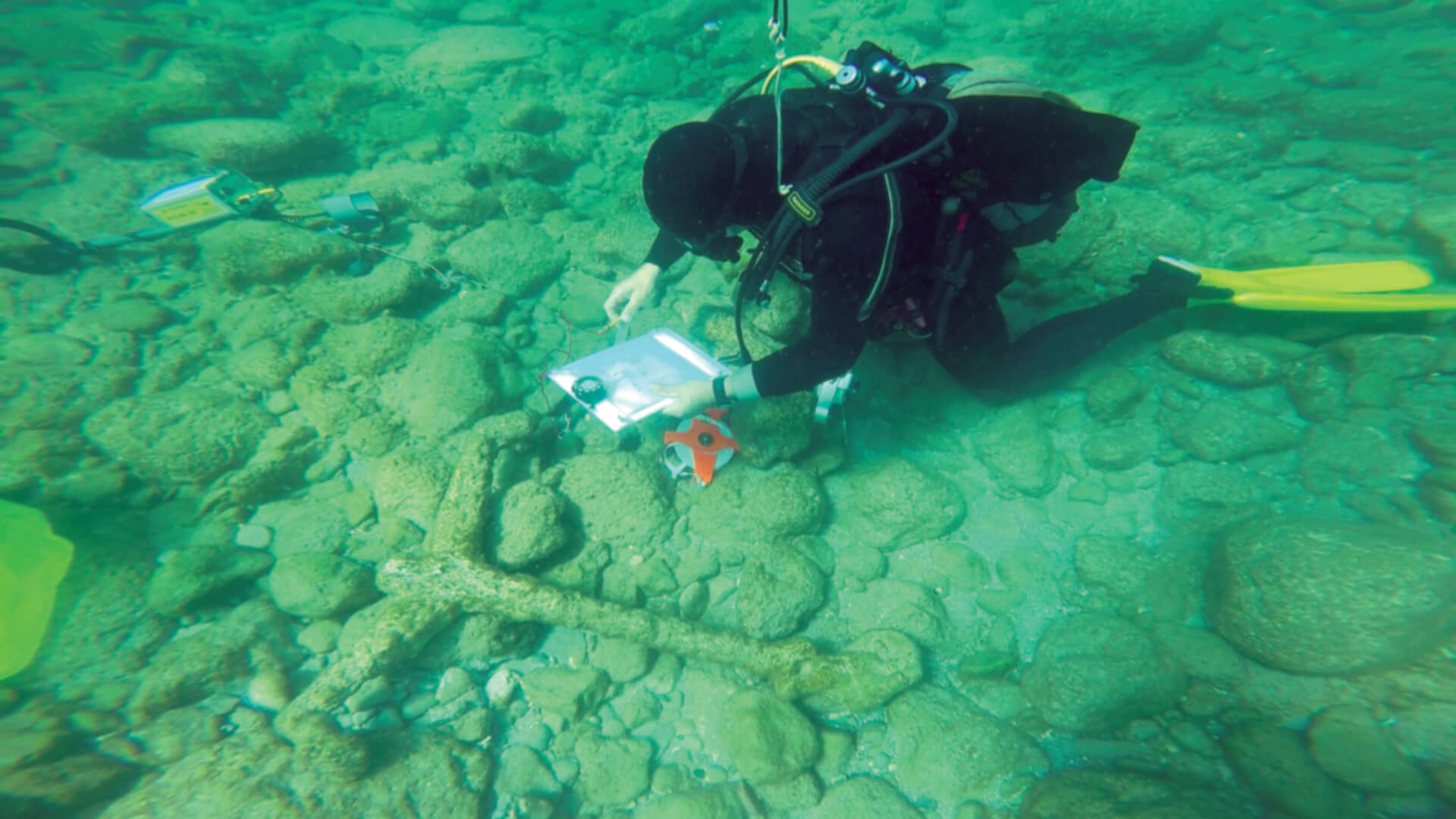
-A diver examines the port’s closing mechanism
Still Standing?
West of the main pier, archaeologists have found the remains of small, artificial islands, made of gigantic wooden frames filled with hydraulic cement. These platforms, roughly twenty by forty meters, served as bases for the crews constructing the walls of the pier.
Rafts measuring seven by fourteen meters, with sides as high as the depth of sea where they were to be sunk, were floated out into position, hundreds of meters from the shore. Made of Italian pine and fir, and reinforced with slats, wooden joints, and beams, they were crafted by the same methods used for seagoing barges.
The cement poured into the rafts was known as pozzolana, a mixture of volcanic ash, tuff, lime, and clay, which hardened on contact with seawater. The first layer was poured while the rafts were still ashore, giving them the rigid stability required to sail through through the few hundred meters of rough surf separating them from the construction site.
When the rafts were in place, iron chains anchored them to the seabed at all four corners, and cement was gradually poured in until they sank to the sea floor. This crucial stage was also the riskiest, and quite a few crates sank out of place or at an angle.
Once in place and aligned, they were filled with pozzolana, forming islands or platforms in the sea.
Prof. Raban estimated that this system allowed six crews to work on the breakwater simultaneously, shortening the duration of the job by two-thirds.
Some crates rotted with time, enabling the waves to eat away at the cement, and now divers swim through the resulting tunnels.
 Graphics: Sharon Ben Yehuda
Ashlars that once formed the base and floor of the jetties are scattered over the seabed, but some are still in place, with their headers (the short sides of the blocks) providing solidity by facing the oncoming waves.
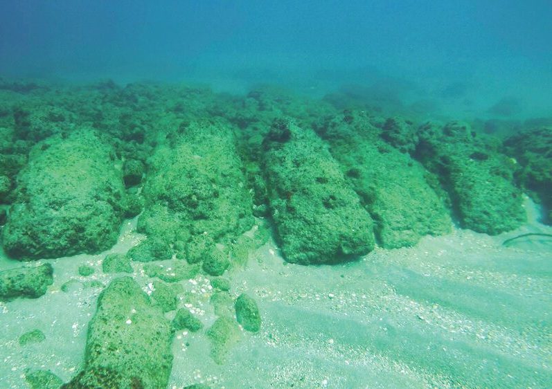 Photo: Jacob Sharvit
Carved sandstone ashlars, all laid as headers to blunt the impact of the waves, now lie at a depth of some five meters. They once formed part of the jetty shoreward of the southern breakwater. Below, part of the Herodian wharf in the northern part of the middle harbor. The similarity between the two is clear, though today only one is above water
The middle basin of the inner harbor was based on a small, natural cove with rocky outcroppings to its north and south. (Caesarea’s marina is located in the cove’s southern section.) The main Herodian remnant here is a secondary jetty. But in the southwest corner of the pool, you can still detect the line of a Roman quay just hitting the surface.
Near the base of the southern jetty, four meters of a channel dug in the side facing the open sea have been exposed. Vertical grooves were carved in the sides of the channel, enabling wooden slats to be inserted. These sluice gates were opened and closed periodically to allow seawater to flood through the channel into the harbor. As the sea rushed in, excess water was pushed out into the open sea, washing away sand and other deposits that built up in the recesses of the port.
Herod’s eastern jetty was discovered during searches for the boundaries of the inner bay; the original stone bollards were still in place. The jetty walls were made of stone and mortar, but now its foundations lie more than two meters underwater. Sand eventually clogged the port’s innermost bay, which was later built over, using Herod’s piers as a base. Originally, however, this part of the port was extensive, covering most of modern Caesarea’s shoreline, where a promenade and restaurants are now.
 Photo: Jacob Sharvit
Sinking Like Lead
Today, most of the Herodian port is underwater. How did such a massive structure disappear, and when?
In 6 CE, just sixteen years after the harbor’s completion, Herod’s heirs lost control of the town, and it became the seat of the Roman procurator of Judea. In 66, with the outbreak of the Great Revolt, Roman general Vespasian hustled his reinforcements through the port of Acre, not Caesarea, though much of the trouble had originated there with clashes between the city’s Jews and non-Jews. When the emperor Hadrian brought in troops to quell the Bar Kokhba rebellion, he too made use of Acre rather than Caesarea. What had become of Herod’s great harbor?
In 1975, the University of Haifa’s Institute for Maritime Studies discovered fault lines off the coast of Caesarea and parallel to it. While parts of the ancient anchorage located east of the modern breakwater had stayed more or less the same height since they were built, everything beyond it – the outer harbor and the southwestern breakwater – was now five to six meters lower. Researchers assumed that the western port had been destroyed by one of the area’s frequent earthquakes.
Archaeologists surveyed the length of the ancient breakwaters, trying to ascertain exactly when they’d sunk. Cargo recovered from the second century onward, from ships that had smashed against the remains of the submerged breakwaters, gave some indication. Most important were lead weights inscribed with the name of the Roman emperor Domitian (81–96), including the title “Germanicus,” adopted after his conquest of Germany in the year 84. These finds suggest that less than a generation after Josephus described the port in all its glory, it had already been so badly damaged that freighters trying to anchor there ran the risk of running aground on the breakwaters.
 Courtesy of Wikipedia
The Herodian pier has been in ruins for centuries, and every winter inflicts further damage
Mediterranean Tsunami
Researchers came up with several scenarios. According to one, the port was doomed from the outset by the seabed’s geological composition. Waves and currents would have undermined the foundations of the jetties, making them sink and collapse into the soft, sandy loam. But this theory was debunked by surveys showing that large sections of the seabed in the area are in fact sandstone, especially near the western breakwater and the center of the port.
More recent suggestions focus on the workings of the inner harbor. Earthquakes followed by tsunamis periodically dumped debris into the inner bay, some say, widening and raising the jetties until the Byzantine period, about the year 500. By the mid-sixth century, the waves had destroyed the pier and blocked the inner port. The effects of the tsunamis that hit the East Asian coast in the last decade support this idea. Layers of deposits off the Caesarea coast, surveyed by the Institute for Maritime Studies, indicate that tsunamis have occurred here. Researchers from the Italian Earthquake and Volcanic Research Institute found evidence of one such off the coast of Caesarea on December 13, 115, and of similar events in the years 306, 551, and 749.
In December 2010, rocks weighing hundreds of kilograms were uprooted from the breakwaters and smashed onto the promenade. In the ensuing rescue excavation, more enormous blocks were found near the breakwaters, having been washed eastward by the force of the waves. The impact of a tsunami, then, can only be imagined.
In view of the damage done by recent storms, and the way modern harbors weathered them, perhaps it was simply a lack of maintenance that destroyed Caesarea’s glory. Without a strong, central regime committing the necessary resources, things soon fall into disrepair.
Judging by the comments of ancient historians, as well as the archaeological record, the port of Caesarea dwarfed other Roman harbors. It was certainly the most sophisticated of its time, and very possibly the first ever to be built in the open sea, where there was no natural bay.
But this structure’s days were numbered. Herod’s heirs were less powerful and connected to Rome than he had been, so the port in Caesarea ranked much lower on their list of priorities. Meanwhile the ravages of winter after winter mounted, possibly exacerbated by the odd tsunami. Within a short time, the enormous effort and investment Herod had poured into Caesarea were sucked into the depths. All that remains are some very scenic ruins, and the thought that man’s achievements – no matter how impressive – are always ephemeral.
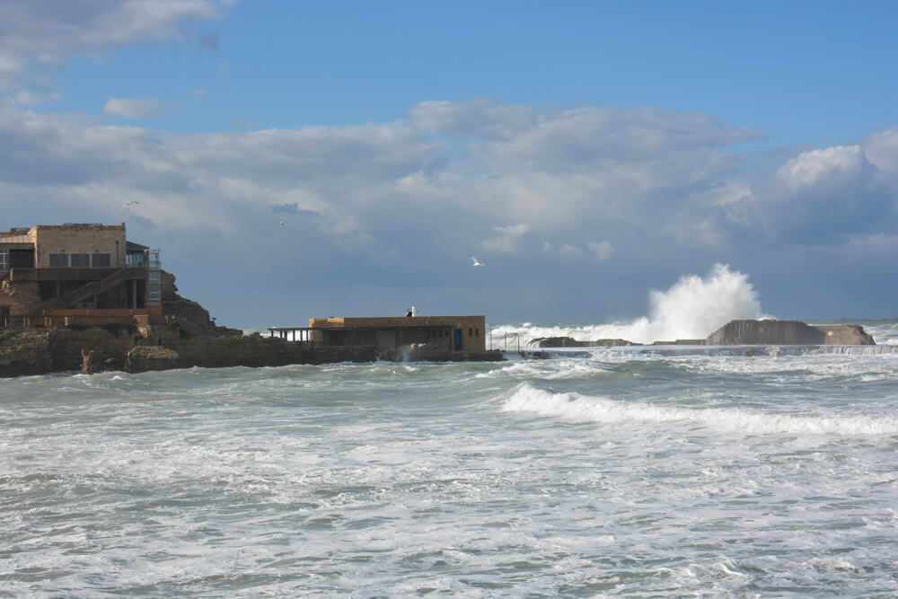 Sara Jo Ben Zvi
Destroyed by wind and wave? Research on the effects of recent winter storms indicates just how damaging they can be. The ancient port during an average gale, winter 2015